
October Odyssey: a weekend of orienteering (Level B) in the North East of England.
Day 1: Chopwell Woods – Saturday 3rd October 2026 (incorporating the selection race for the England Junior Team for Interland 2027). Chopwell is a mixed woodland on the fringes of Gateshead, 18 miles from Durham, 12 miles from Newcastle. Details here
Day 2: Edges Green – Sunday 4th October 2026 (incorporating the North East Championships). Edges Green is 2 miles north of Hadrian’s Wall, about 3 miles from the infamous Sycamore Gap and 5 miles from Haltwhistle. The YHA (3 miles away) offer accommodation at The Sill for anyone wishing to make a weekend of it.
Final Details for Day 2:
Venue: Edges Green. Satnav Postcode NE49 9PP
Travel: The event will be signed from B6318, signposted Cawburn https://what3words.com/testy.holds.humble. Travel for approximately 2 miles along a narrow road which will take you directly to the parking.
Parking and Assembly: adjacent to the competition area https://what3words.com/rushed.audit.newspaper
The North East Championships: to be eligible for this competition, you must be a member of a NEOA club (CLOK, NATO, NN) and enter your age class. NEOA champion certificates will be awarded for all male and female age categories. You may run up but please declare your intentions to the organiser.
Entries: Online entry is now closed.
Late Entries: Limited spare maps are available, please contact the organiser.
Entry on the Day: Light Green, Orange and Yellow subject to availability.
Registration/Download: located in the parking area. Open from 10.00 for collection of hired dibbers, Yellow maps, EOD and general enquiries.
Fees: Senior BO members – £12, Senior non BO members – £14 (see below), Juniors/Students – £5, Senior Novice (Orange and Yellow courses only) – £5.
Enter both days and save £4 (seniors), £2 (juniors)
BO Non-Members: Important notice – non-members are not insured under British Orienteering’s public liability policy. By entering this event, you acknowledge that you are participating at your own risk.
Start: Starts from 10:30 – 12:30, no start windows simply turn up and go when a suitable start time for your course becomes available. Punching start for all courses, -3 minute call up in operation at the senior start.
There are 2 starts. The junior start for Yellow (collect maps at Enquiries), Orange and Light Green courses leaves north from the parking field allowing juniors immediate access to the open moor. Allow 10 minutes.
The main start is a short walk following the road north from the parking field. Competitors should take care as farm vehicles frequently use this road. Allow 5 minutes.
Finish: located on a gate with immediate access to the road leading back to the parking, a 900m walk. Please note, you must report to download on returning from your run even if you have not completed your course.
Courses close at 14:30
EPS: This event will use the SportIdent electronic system. Control stations will be enabled for touch free punching (SIAC) but competitors will need to punch the start and finish control. All control sites will have a backup system in the event of control failure. This involves a tag with a unique 3 letter word instead of the traditional punch. Remember the word and report it to the download team to prove you have visited the control.
Dibber hire: dibbers are available for hire at a cost of £1. There is a charge of £30 for lost or damaged dibbers. Make sure you collect your dibber from registration/download before leaving for the start.
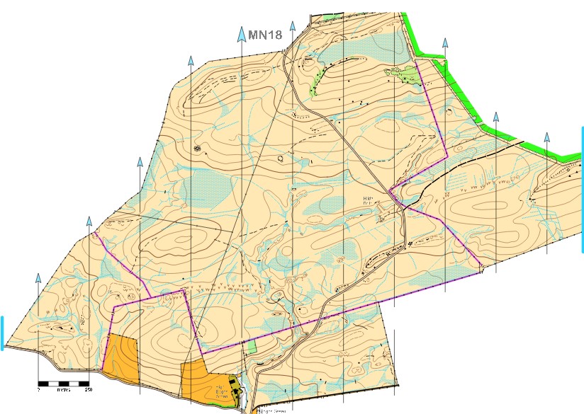
Map: A 1:10,000 map, updated to the current standard and with some map corrections this year. Last used in 2018 and nothing on Routegadget, so an image of the old map is shown below. Note there are some powerlines crossing the area; they are used as line features on lower level courses, but are removed from the map on TD5 courses.
Note the Yellow course has one partly taped leg signified by a dashed line between controls.
The pits are generally large and deep, depressions vary in size but are generally much shallower.
Rock features are mostly small, but are distinct in the terrain. The green hatched areas are best avoided (Brown), also There are large areas of reeds not mapped making some of the marshes more difficult to identify.
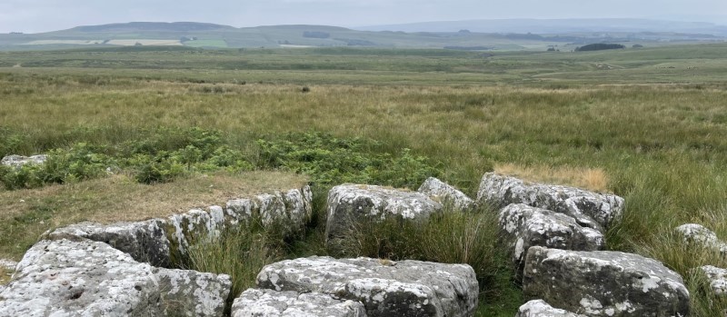
Terrain: All courses use the moor which is open (exposed) moorland, predominantly rough open pasture with varied runability. There is evidence of historic mining with multiple pits, also a capped off mine entrance (Hilda Drift 1941). Some parts of the area are separated by fences and walls, available crossing points will be clearly shown on competition maps these must be used to avoid damage. Some gates are locked and will need to be climbed, please leave gates as you find them. One of the crossing points is a cattle grid, though a side gate is available, A minor road bisects the area though it has little traffic and very clear visibility.
Control descriptions: descriptions will be on the map and loose descriptions will be available in the start box
Safety Information: Due to the exposed nature of the moor, competitors must carry a whistle and waterproofs may be compulsory. Competitors are free to carry a mobile phone and the signal is good. The planner has encountered cattle on the area which move away when approached. A comprehensive risk assessment has been carried out by the organiser but please remember that orienteering is an adventure sport and competitors take part at their own risk. You must report to download even if you do not finish or retire from your course. The nearest Urgent Care centre is Hexham General Hospital (18 miles / 30min), alternatively the Cumberland Infirmary, Carlisle (26 miles / 45 min).
Facilities: Toilets will be in the parking area.
Basic First Aid facilities will be available at registration/enquiries.
Sorry, there will be no water at the finish, please bring your own supply.
Dogs: Dogs will not be allowed on the area and must remain tied up or on a lead in the parking field only.
Thanks: Many thanks to Mr Weatherson of Edges Green Farm and Mr Bell of High Edges Green farm for kindly giving us permission to use the area.
Officials:
- Organiser -Boris Spence (NN) Email: northernnavigators@gmail.com
- Planner – Allen Banister (NN),
- Assistant Planner (Junior courses) – Debby Warren (NN)
- Controller – Andy Lewsley (BL)
Finalised courses
| Course | Course Combos | Length | Climb | Map Scale | Start |
| Brown | M18, M20, M21, M35, M40, M45 W21, W35 | 8.5 km | 150m | 1:10,000 | Main |
| Blue | M16, M50, M55, M60 W18, W20, W40, W45 | 6.1 km | 115m | 1:10,000 | Main |
| Green | M65, M70 W16, W50, W55, W60 | 3.9 km | 65m | 1:10,000 | Main |
| Short Green | M75, M80, M85, M90 W65, W70, W75, W80, W85, W90 | 2.9 km | 50m | 1:7,500 | Main |
| Light Green | M14 W14 | 3.7 km | 50m | 1:7,500 | Junior |
| Orange | M12, M14B W12, W14B | 2.3km | 40m | 1:7,500 | Junior |
| Yellow | M10, M12B W10, W12B | 2.3 km | 30m | 1:7,500 | Junior |
Please upload or draw from memory your route on Routegadget
Splits analysis courtesy of Routegadget here
Final Results here
NEOA Champions:
| Age Cat | Male | Female |
| 10 | Kit Downing (CLOK) | Christine Zang (NN) |
| 12 | ||
| 14 | Oliver Puschmann (NN) | Fern Downing (CLOK) |
| 16 | Thomas Puschmann (NN) | Nell Downing (CLOK) |
| 18 | Isla Simpson (CLOK) | |
| 20 | ||
| 21 | Julian Simpson (CLOK) | Laura Hindle (NATO) |
| 35 | Lucy Tiffin (CLOK) | |
| 40 | Charles Hazelrigg (NN) | |
| 45 | Andrew Stimson (NN) | Rebecca Simpson (CLOK) |
| 50 | Francis Shillitoe (NATO) | Joanne Field (NATO) |
| 55 | Hugh Potter (NATO) | Sue Metcalf (NATO) |
| 60 | Dave Riches (CLOK) | Gwenda Cavill (NATO) |
| 65 | Graeme Beavers (NATO) | |
| 70 | Paul Taylor (CLOK) | |
| 75 | ||
| 80 | Helen Rafferty (NATO) | |
| 85 | ||
| 90 |