Welcome to the 2nd Edition of NNews – a quarterly newsletter from Northern Navigators.
The newsletter contains details of upcoming events and contributions from our members. Thank you to everyone who has contributed to this edition.
Please let us know (newsletter@northern-navigators.org.uk) if you have any comments or wish to contribute to any future editions.
Contents:
Upcoming Events
60seconds with…
NN’s first Come and Try It event
Events roles introduction
Planning a National event
First Timers at the JK
Compass Sport Trophy – Battle of the Clubs
Organising a National Level Event
A history of Houghall Woods
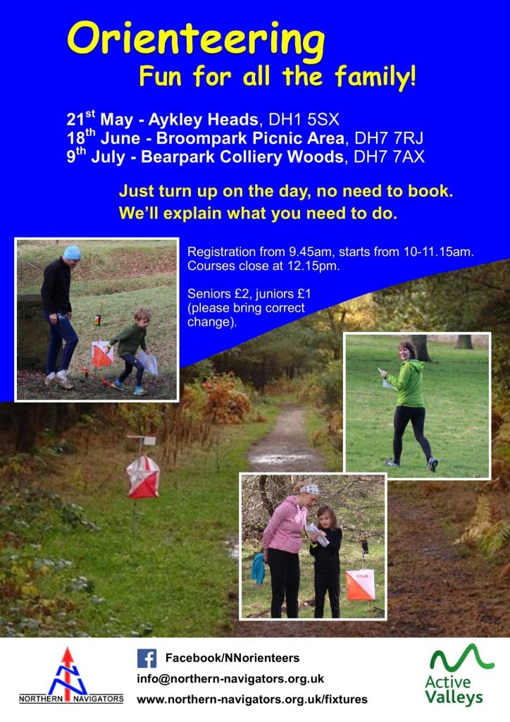
Upcoming Events
| Friday 3rd June – Chasing Sprint event; Fellgate Estate, south of Jarrow (NN, local) Saturday 4th June – Sprint event; Stockton Riverside (CLOK, regional) Sunday 5th June – Newcastle City Race; Newcastle (NATO, regional) Wednesday 8th June – Military League North; Tees Wildlife & Preston Parks, Eaglescliffe (BAOC, local) Wednesday 8th June – Summer Series; Preston Park, Eaglescliffe (CLOK, local) Saturday 11th June – British Sprint Relay Championships, Leeds Becket University (YHOA, major) Sunday 12th June – British Sprint Championships, Leeds University (AIRE, major) Saturday 18th June – “Come and Try It”; Broompark, Durham (NN, local) Wednesday 29th June – Military League North; Flatts Lane Country Park, Middlesbrough (BAOC, local) Wednesday 29th June – Summer Series; Flatts Lane Country Park, Middlesbrough (CLOK, local)Saturday 2nd July – Penrith Urban Event; Penrith (BL, regional) Saturday 9th July – “Come and Try It”; Bearpark (NN, local) Saturday 23rd July – Local/Cross-country; Askham Common (BL, local) Sunday 7th to Friday 12th August – Lakes 5 Days; Lake District (national) Friday 26th to Monday 29th August – White Rose Weekend; Gilling East, Yorkshire (EBOR) Saturday 28th August – BL Long-O; Bampton Common South (BL, local)Saturday 10th September – Urban event; Richmond (CLOK, national) Sunday 11th September – Urban event; Ripon (CLARO, regional)Saturday 1st October – October Odyssey Day 1; Druridge Bay (NATO, national) Sunday 2nd October – October Odyssey Day 2; Morpeth (NATO, national) Sunday 9th October – Regional Event; Cod Beck (CLOK, regional) Sunday 30th October – North East Score Championships; Fontburn Reservoir (NN, regional)Friday 27th to Sunday 29th January 2023 – Edinburgh Big Weekend; Edinburgh (EUOC, local/regional)Sunday 12th March 2023 – CompassSport Trophy Heat; TBC, likely Beanley, Alnwick (NATO, national)Friday 7th to Monday 10th April 2023 – JK; Lancashire and South Lakes (NWOA, major)Sunday 30th July to Friday 4th August 2023 – Scottish 5 Days; Moray (national) We also have a weekly club night on Wednesdays at 6.30pm in the vicinity of Durham City. Contact info@northern-navigators.org.uk for further details. |
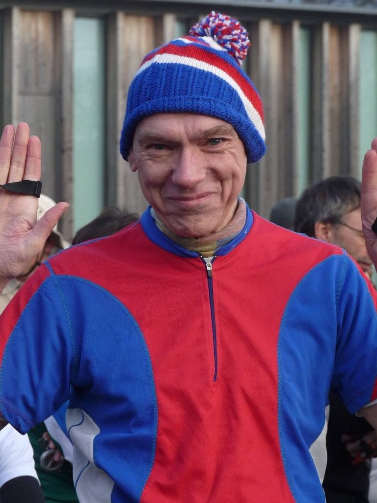
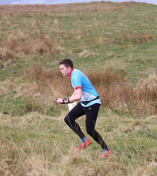
60 Seconds with…..Barry Young
What’s your role in the club? Club membership secretary which I’ve held for around 7 years.
How long have you been orienteering? Probably around 12 years with NN. I also did some in London with SLOW around 40 years ago which included a relay run along the North Downs Way. Luckily it had just opened so was fully waymarked.
How did you get into the sport? For NN, I was cycling home one night and Rob was running an event at Hebburn riverside. He was in a good mood and invited me to join and has never regretted it.
What’s your warm-up routine? Usually by taking extra time to controls 1 and 2 by taking a long route.
What’s your best result? Apart from the O – Ringen, I think I won one of Boris’s events at Albemarle. He probably rigged it by getting everyone else to carry Bergens.
What do you eat before your run? Porridge – but I eat that anyway and not as a race special.
Thumb compass or base-plate? Thumb.
Do you take compass bearings? Sometimes. But I use the stars for night events.
What’s your favourite orienteering area? I’ve enjoyed most of the Lakes areas (Blea Tarn was one favourite) except for Bigland. I recently visited Fossum in Norway which is a superb area for orienteering and is also used by the Norwegian biathlon teams.
Lycra or baggy? Both.
Moorland or forest? Moorland as I can see the contours.
Urban or cross country? Cross country definitely. I’m never sure about the rules on Urbans on jumping walls.
Do you pace count? Yes, but I need to recalibrate as my stride is much shorter.
What’s your worst mistake? Every race is an adventure. Eston Bank hasn’t been good – last time I had to stop to tie my shoe laces, put down the map and a dog got hold of the map and ran off with it. I found the last 2 controls much faster without it. Jesmond Park is very dangerous. At an NE Score Champs I managed to disturb a hornet’s nest (NATO had handily installed a control nearby and had failed to map the nest) and got stung 10 times. I ran much better after that happened. But they didn’t give me any extra points for the stings. I suppose that I should’ve used another route.
Are you a results nerd? I always look forward to my much improved next result!
What do you think of Routegadget? No.
Barry Young answering questions from the Warrens
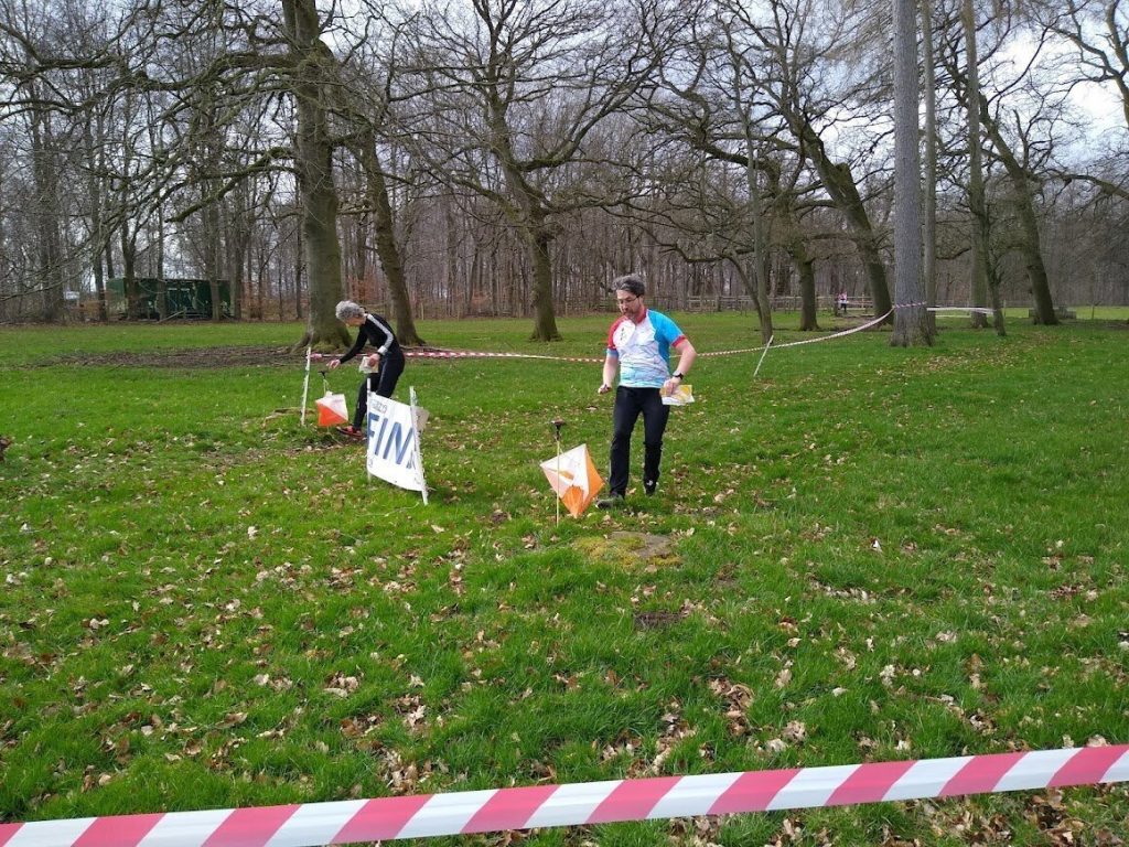
NN’s First Come and Try It event
On the 21st of May, NN held its first Come and Try It event at Aykley Heads to introduce new people to the sport and it was a resounding success. We had an impressive turnout of over 40 people and everyone seemed to really enjoy it.
I planned 3 courses starting at novice with progression to intermediate and with an advanced course aimed at more experienced orienteers. Some people even had two runs and who could blame them when the weather was so fantastic. It was also nice to see such a high number of club members show up to offer assistance to those who are new to the sport, couldn’t have done it without you. Here’s hoping that we have another cracker when we hold the second event at Broompark on the 18th of June.
Barney Warren
An introductory guide to…Event Roles
In a subsequent article, Rob McKenna will explain his role as planner for a national level event and later in the newsletter Boris Spence provides an insight to his role as organiser of the event. Some readers will be well aware of the roles required to host orienteering events, however I thought that for others some background may be helpful.
Orienteering events only happen with the help of many volunteers – from the person(s) who mapped the area to those who help collect in controls at the end. However, there are 3 main officials appointed for each event: Organiser, Planner and Controller.
The organiser establishes the framework for the event for everything which is not the course itself – this likely includes coordinating the entry process, finances, publicity, site access, facilities, the start/finish area and procedure, land access permission, timing/punching equipment and event volunteers. The organiser is also responsible for ensuring the safety of competitors and the public (in conjunction with the planner).
The role of the planner is to plan the orienteering courses. These should be in accordance with British Orienteering guidelines and designed to be suited to the expected participants for each course. The planner will be involved in safety discussions with the organiser relating to the competition area.
The controller will ensure that the event meets the required standards and British Orienteering rules. They will check and advise on the work of the organiser and planner, ensuring that a risk assessment has been thoroughly carried out and ratifying all the final paperwork for the event (e.g. the maps!). A controller does not have to be appointed for a local event, however there must be a controller for regional events, who should be from a different club to the club organising the event. For national events they must be from a different club and for major events the controller should be from a different region.
For all three roles the British Orienteering rules suggest (or in the case of controller, require) a certain level of experience and training – new starters will start as an official at a local level event with support from more experienced officials.
The club are always looking for new people to take on event roles – if it is something that would be of interest then please let us know. The first thing will be to attend a certified British Orienteering Safety Course which gives you an overview of the issues and potential dangers of staging an orienteering event.
Matthew Foskett
Planning a National Level Event…
Shaftoe Crags – 2nd April 2022
Planning for this event started way back in October 2021, although it was originally envisaged that the event would have been staged at The Cragg Estate.
Paul Murgatroyd, British Orienteering Head Coach for Talent, had approached NATO to run a couple of low key but technical events over the Northern Championships weekend in April. The Long Distance event on Sunday at Simonside would be a selection race for the British Junior Squad. NATO had also offered an urban sprint on the evening of 1st April in Cramlington and NN was approached to host a Middle Distance on the Saturday. It was agreed that this would be a good opportunity to raise the region’s profile prior to the forthcoming Newcastle City Race weekend in June.
I initially suggested that The Cragg Estate or rather Chesterhope Common may be a good venue and would take minimal planning effort as we had previously staged a Middle Distance event there in 2016. I felt that the area seemed to be ideal for this type of orienteering, which had also hosted the British Relay Championships in 2014. Unfortunately when Boris contacted the land owners he was told that it was not a good time of the year for them as they would have young calves on the area and didn’t want them disturbed.
There were a number of other possibilities to be investigated including – Shaftoe Crags, Fontburn Reservoir, Bewick Moor and Chopwell Woods. Shaftoe Crags was the preferred choice, but in the past we had only used it January / February and it was feared that April may not be a good time for the farmers due to lambing.
There are two farmers at Shaftoe, Mr. Robson and Mr. Leiper, and both happily agreed that the event could go ahead. They have been very helpful and welcoming in the past and a great deal of thanks must go to them for their co-operation.
Duncan Archer of CLOK was duly appointed as controller and with Boris Spence as Organiser, planning got under way. Early planning considerations revolved around supporting a weekend of events leading up to the Northern Championships, but these changed when it was revealed that this event was also to be a GB Junior selection race, later complicated by also being assigned as a UKOL league event, hence the event was upgraded from ‘local’ to National status.
The guidelines for these two types of event are subtlety different, but an emphasis had to be put on the Junior selection race in an attempt to emulate the type of races they would encounter in the coming months and into next year.
The British Orienteering guidelines suggest that the Middle Distance profile should be technical with an emphasis on detailed navigation and shifts in running direction out from controls. The longest course should be planned such that a top elite-standard competitor would win it in 30-35 minutes.
As this event was also to be used as a selection race for the British Junior Squad, Paul Murgatroyd felt that winning times for the juniors should be in the region of 20-25 minutes to meet his criteria. This meant planning courses that they would run to try and achieve winning times of 20-25 minutes.
Although Shaftoe Crags can be a very fast area, past results showed that running speeds of around 6 mins/km were possible, this being with good standard local runners. However, on checking some other past results of Middle Distance races involving top juniors, I discovered that they could produce running speeds of around 4-5 mins/km, so courses were planned with this in mind and an emphasis on the juniors.
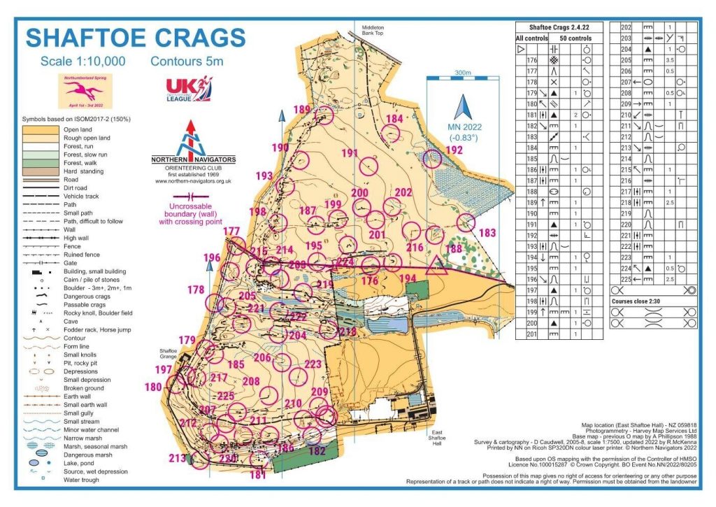
Shaftoe Crags is basically split into two quite different areas, with the northern part being generally fast but devoid of significant features. While there are some interesting rock features along its western edge, planning for a middle distance event made it difficult to incorporate these fully into the courses.
On crossing the gates into the southern section the terrain changes to become a little more physical with a lot more rock features, although not a lot of technical contour interest. There is a steep rocky slope along the southern edge with many impressive crags and boulders but it was felt that this would not be suitable for a fast paced event such as this. The southern section does have an additional ‘meadow’ area and a small block of woodland with some interesting crags, but access to these is awkward with more gates and the wooded area was badly affected by recent storms, so I decided not to use these. The existing map was fairly up to date and just needed tweaking to align with current magnetic north and symbols changed to comply with ISOM2017-2.
At a late stage, Allen Banister came up with some LIDAR data for the area and although I did start to alter the map, there were some parts of the southern steep slope that would have needed several site visits to accurately locate some of the rock features, so I had to leave it for another time.
The start and finish for the event was basically dictated by the Yellow and Orange courses. The area has very few line features for these courses to follow.
The start worked well being close to assembly and parking which engendered a good atmosphere. We were blessed with good weather on the day which made the longish walk back from the finish not too bad.
The provisional courses sent to the controller were a balance of running equal distances on both the north and south sections. However, Duncan thought that the north was a bit too easy and suggested that I should concentrate on developing the southern section a bit more. We eventually agreed on a set of courses and I went off to the area to tag the control sites.
Both myself and Boris visited the area and to our horror discovered that the stile I had planned to use at the west side of the map had been taken away and the wall filled in with a barb wire on top. Apparently, the farmer had been having some problems with his cows ‘kissing’ his neighbours cows over the boundary wall which was causing some damage to it. He had erected a single wire electric fence on his side of the wall to try and overcome the problem, but also removed the stile.
There were a few options, firstly erect a stile in place of the original – not something we were keen on as it was a long way to drag a wooden stile to. The second option, which we finally agreed on was to re-plan the courses to use the central most gates in the boundary wall. This being a fast paced race it was felt that the gates would have to be tied open and marshalled. I got home, restructured the courses and they all seemed to work. Duncan reviewed the changes and with a few minor changes we were all set to go, pending his checking the control sites.
When tagging the sites I had used some small canes with a prominent tag number on them – this does make it easier for the controller when checking sites. I had printed the labels for the tags in a bit of a hurry, not checking them thoroughly before attaching to the canes and only noticed that a few had differing numbers on each side of the tag when putting them out. At the time I only had a red biro with me to make a quick alteration, which seemed to be fine for final control setting. I hadn’t realised that over the next few weeks that the alteration would have faded leaving the old number very prominent. Worse again that a few competitors would use the tag as an identifier for the control they were seeking, being more prominent than the actual number on top of the control box. This turned out to be a major issue for some competitors on the Green course even though the control in question was not on their course. The Jury was convened to field a protest and a solution to the problem was agreed amicably.
The early start times seemed to be a bone of contention for some given that they would be travelling a long distance to get to the event. Being a selection race, the juniors were seeded by Paul Murgatroyd (BO Head Coach for Talent) to ensure a fair race. This unfortunately resulted in pre-entry start preferences not being adhere to.
The initial concept was to have all the juniors start at 3 minute intervals to avoid following and pack running. On the Green course this would have required a 2 hour start window just for the juniors on that course. We agreed that starts would be brought forward to 10:00, but even this would have meant that starts for non-juniors on that course, even at 1 minute intervals after the juniors, would stretch to 13:30. It was finally agreed with Paul that seniors could be interspersed with the juniors without compromising their race too much. In hindsight I should ideally have planned separate courses for Blue, Green and Short Green to accommodate the junior selection race, but changes to the status of the event and closing date looming had meant that this wasn’t feasible in the planning time left available.
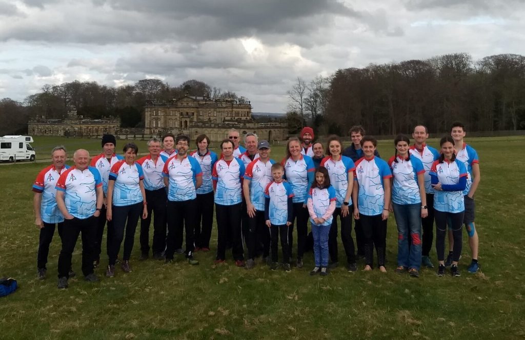
Northern Navigators is a small club and it has been some time since it has hosted a prestigious event. The organisation and planning considerations for events such as these vastly differ from the type of events that the club normally hosts.
Thanks must go to the many club members who gave up their time to ensure that this event ran smoothly and to members from other clubs who assisted us on the day. The many smiling faces and positive comments have made all the effort really worthwhile.
Rob McKenna
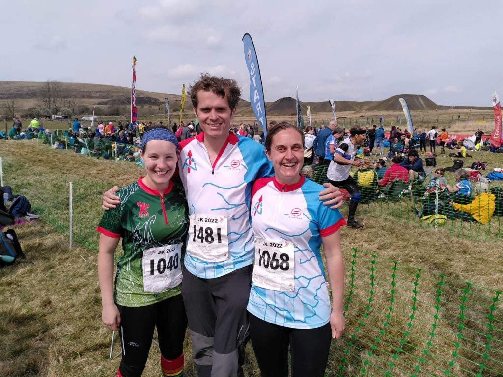
First-timers at the JK
You don’t have to be around Orienteers very long before you hear about the JK. By the time we found out that ‘JK’ stood for the Jan Kjellström International Orienteering Festival we had already caught the O bug and survived our first Scottish 6 (3) days. We therefore signed up enthusiastically, keen to experience whole new ways of feeling lost, this time with South Wales as the back drop.
Friday, the first of the four days, was a sprint event in the campus of Swansea University. We arrived at Swansea train station the night before and spent a pleasant evening in the city eating, drinking and speculating about the next few days. The following morning we cafe-hopped along the beach to the university, feeling more like holiday-makers than participants in a sporting-event. Eventually we reached day 1’s arena and we were struck with the scale of the JK for the first time as we joined the crowds bustling towards registration. The start was past a very public finish and we began to feel some nervous excitement as we watched the elites completing their run-ins to live commentary. Soon enough, we were off, and with the exception of a brief confused pause caused by a non-punching start, the race flashed by, darting between, under and over the buildings, stairs, roads and gardens of the campus. Suddenly, we were back by the finish, relieved that commentators had ignored our run-ins. We saw the Warrens and some Hampshire-Wrights by download, collected our very snazzy JK T-shirts and headed back towards the station and Abergavenny for day 2.
Clydach Terrace was the site for Saturday’s middle-distance. After the clean lines and open spaces of Swansea Uni, it felt very difficult. I got lost near the first control, emerging on a path I wasn’t expecting and wasted several more minutes re-locating. It didn’t help that the power-lines weren’t mapped. I improved a bit, but couldn’t always match the complex undulating moorland and criss-crossing paths to the map of the same and finished feeling I could have done better.
The long-distance on Sunday was at Pwll Du. The terrain was similar to Clydach Terrace but everything was bigger and the features felt more distinct. It was great fun and similar to the type of Orienteering we had enjoyed so much in Scotland. It was very tiring. There was a lot of climb and some big distances – the leg to the last control on the W21L course spanned the entire map. The view from the highest part of the course was spectacular, and running along the top of the hill felt satisfyingly epic.
Monday, the relay, was at Caerwent, an army training base. I had to leave for work, but Meg jumped ship and joined an ad-hoc CLOK team with some trepidation. Meg describes her first O relay as exciting, a great spectator sport and additional pressure not to get lost. The area was a fast, fun mix of woodland and army buildings. A high density of other competitors gave it a chaotic and much less solitary feel than the previous days. Managing not to face-plant on the run-in felt like enough of a success!
The JK lived up to its reputation (and Wikipedia description) and we had a great time in the Welsh sunshine. We’re already looking forward to the next JK in the Lakes in 2023.
Article and photos from Thomas Dutton
Compass Sport Trophy – Battle of the Clubs
The Compass Sport Cup/Trophy, for those of you unfamiliar with it, is an annual event where clubs across the nation battle it out to be top dog.
This year, we rallied to the battle fields of Windy Pitts and Duncombe Park, the stronghold of our rivals EBOR but coordinated by their allies HALO.
We clashed with our usual adversaries – Courageous CLOK, Noble NATO, Courtly CLARO, Heroic HALO, Emboldened EPOC, Eminent EBOR and Stout-hearted SELOC.
The terrain was classic North Yorkshire vegetation with some uneventful long legs, the use of the large network of paths proving essential for success. We lined up against our opponents and over the next few hours we fought heroically over the rugged landscape.
As the dust settled, it emerged that our efforts had paid off. We had defeated some of our enemies to land 5th place with a very creditable 1218 points, beating NATO (1208 points), HALO (1188 points) and SELOC (1158 points). This was a massive breakthrough considering results on the last few occasions we have met have shown a woeful last place.
As far as scoring goes, the young guns (Yokub , Maya and Barney) put in a sterling performance, the fresh levies (Elizabeth, Meg, Matthew and Andrew) were essential to our success and the veterans (Rob, Bob, Nigel, Kath, Julian and Debby) sealed our 5th place victory. Not to mention the remaining hardy warriors (11 others in total) who were a credit to their squad by holding the line and ensuring our rivals were deprived of valuable points.
Amusingly, we could have achieved a 4th place had it not been for the Turncoat in our midst, who, having defected from CLARO, shot us in the foot by mis-punching. No hard feelings there, Allen – it was all good fun on the day!
Lastly I must mention our battle dress which was integral to our victory -there was definitely a sense of pride in being a member of NN.
Seriously folks, thanks to everyone for taking part. It was a memorable day and I can’t wait for our next gathering!
Debby Warren
Organising a National Level Event…
Shaftoe Crags – 2nd April 2022
As a club we are always trying to develop club members in the various event roles. One such role, is the event organiser. Therefore, let’s look at the Shaftoe Crags Event as an example.
The club were requested to plan and organise a National Middle-Distance Event including a GB Junior Selection Race on the 2nd April. This made the task for the planner, (Rob Mckenna) more of a challenge to plan suitable courses in line with British Orienteering (BO) requirements and rules. For me as lead organiser, it was the same as any other large event.
The selection of Shaftoe Crags for the event, at this time of the year was a concern, due to the lambing season. However, the two Farmers/Landowners, Mr Robson and Mr Leiper were, as in the past, both enthusiastic and very accommodating which ensured a successful event. Without this support, we would have struggled to put the event on. Establishing a good relationship with landowners is very important.
So, let’s look at the organiser’s responsibilities;
- Establishing the event framework – this includes everything before the start and after the finish including the start & finish.
- The safety & welfare of the participants and other members of the public in the event area. This will involve ensuring that the following are carried out: land permission, event registration, access, car parking, assembly area, publicity timescales and in conjunction with the planner the courses.
- Risk assessment, risk management and contingency plans
- The equipment to be used including electronic punching, clocks etc
- Volunteer helper requirements
- Event safety and missing competitor procedures
The major issue for most events is car parking, which includes Motorhomes, along with the complication of the weather. The reason is you have no control over the weather, and although you may have a plan to get vehicles in and out of an area or even to move to a different area, you just hope the weather is kind. We were very fortunate, the rain stopped two days before the event, which was a big relief.
Then, the next issue is the equipment needed, most of which is held by the club. However, with this event we needed to use SI Equipment, and arranged to loan the CLOK Equipment, which we needed to pick up and return.
If you attended the event, you would have noticed the area is covered by crags, large rocks and boulder fields. As the organiser you are required to complete the Risk Assessment, in conjunction with the planner and agreed by the Controller. (Duncan Archer, CLOK). With so many obstacles on this area, the risk assessment must take into consideration the expected routes that competitors will take. Of course, this is difficult judgement to make. So, you can only make an assessment based on the knowledge of the Controller, Planner and Organiser. Consequently, you should try not to get stuck with too much detail.
The final component to ensure a successful event is “Volunteers” to cover the many roles, Registration, Car Parking, Download, First Aid and Control Collection. Each of these are important, not just for the event, but to ensure the club maintains it very good reputation.
Remember, if you are interested in trying this role, you can shadow the Organiser on any of the club events.
Boris Spence
A history of Houghall Woods
In this article I take a look at the history of one of our orienteering areas.
Houghall Woods is an area that we regularly use for events and Club nights – often it is run as part of the ‘Durham University Estates’ map. It has regularly been the location for the NN Boxing Day Charity Score. The contours of the wood are also included on the Durham University Orienteering Club tops.
The woods are located to the south east of Durham City, beyond the University Science Site. The trees hug the steep east and south facing slopes of Mount Joy and Buck’s Hill, looking out over the valley where the River Wear meanders below. The name Houghall derives from the old English for ‘water-meadow by the hill spur’ and the first known reference is in 1115 CE.
Since 1836 the Woods have been owned by the University, having previously been the property of the Cathedral. The agricultural land to the east and south of the main woods were bought by the Council from the University in 1919 and are now the site of Houghall Campus, East Durham College.
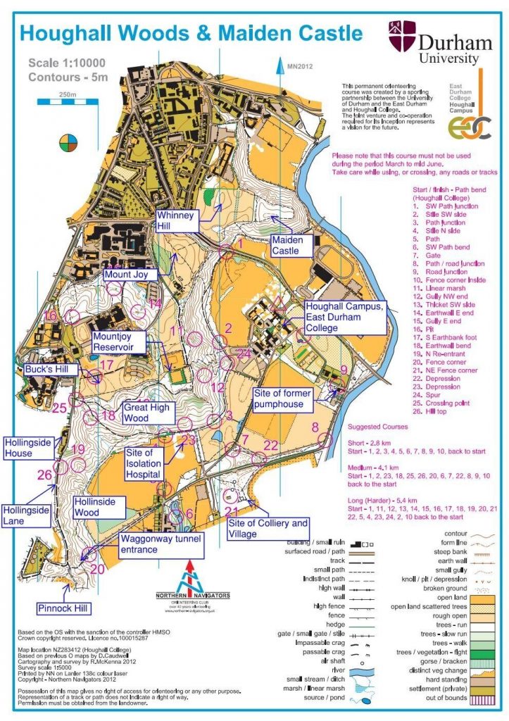
The northern section of the woods is separated from the ancient fort of Maiden Castle, sited on a spur of Whinney Hill, by the A177. This road passes through a cutting between Whinney Hill and Mount Joy at this location. The name Mount Joy refers to a location where pilgrims piled stones having gained site of their destination – presumably out of joy at seeing the cathedral in this case! It is also reputed to be the location where the monks carrying St Cuthbert’s coffin met a maid who had lost her dun cow. Legend states that this encounter enabled then to find Dunholm and establish Durham City.
Heading South from Mount Joy is Mountjoy Reservoir. This reservoir was completed in 1849 and was initially fed by a waterpipe which passed up the slopes of Houghall Woods from the waterworks near Shincliffe Bridge, where one of the buildings is still know as the Pumphouse. This provided the first filtered water to Durham City. In 1880 the Durham Water Company was taken over by the Weardale and Shildon Water Company (later Weardale and Consett) and alternative water sources were used. The reservoir itself however remains in use and was extended in 2007. The extension uncovered Neolithic artefacts with historians describing the location as a prehistoric Glastonbury!
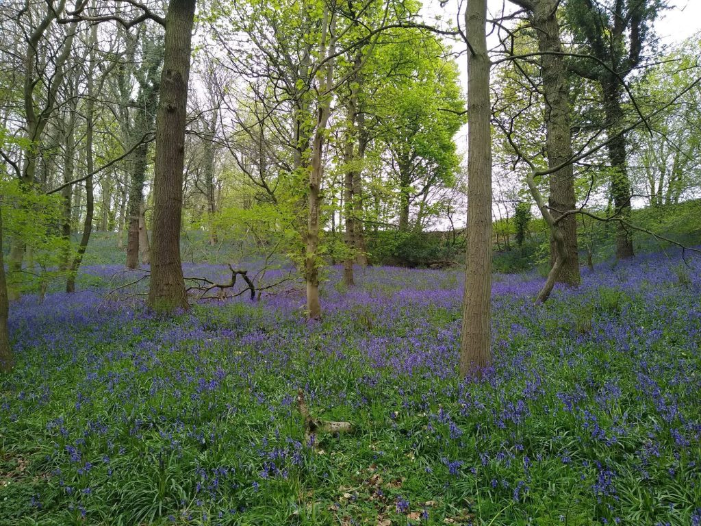
Beyond the reservoir, Houghall Woods bend around to run from East to West – this area is known as Great High Wood. This location has some of the best bluebells around each Spring. In fact it was these Bluebells that Dominic Cummings is alleged to have visited during lockdown (something he denied).
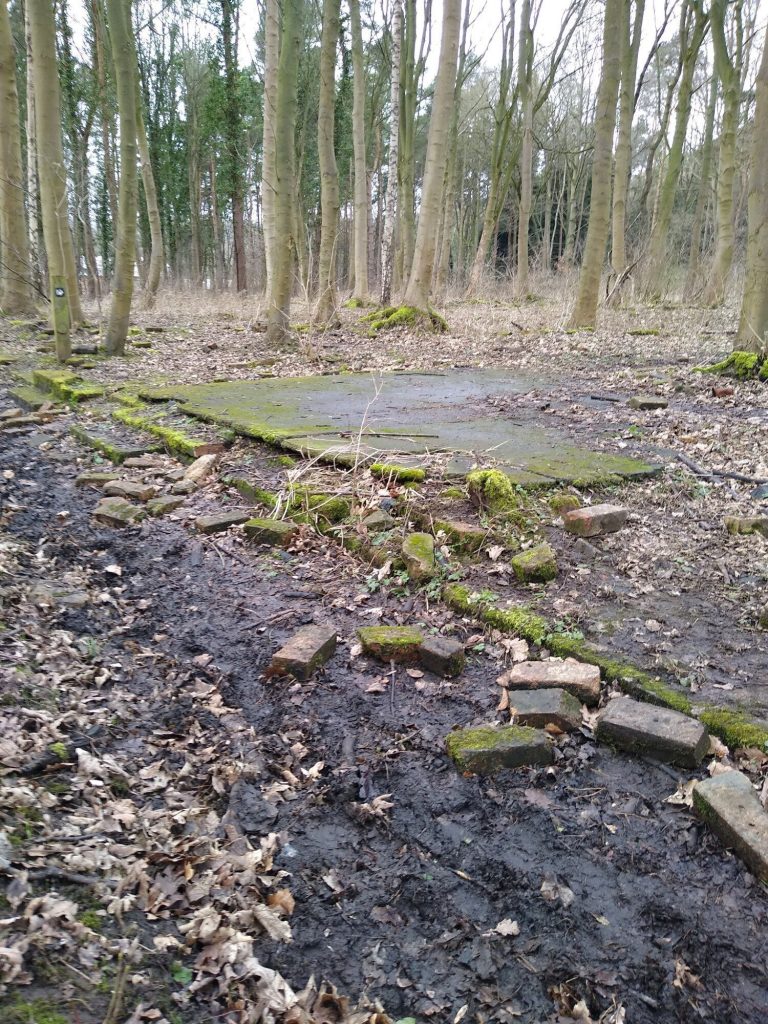
There are fields immediately to the south of the woods here – often containing sheep. However, go back 100 years and this was the site of an isolation hospital for infectious diseases! The hospital was on this site from 1893 until 1949, prior to that the building was a school. From 1841 until 1884 a colliery operated in the small woods which are sited to the south across the lane from rest of Houghall Woods. This lane was previously a waggonway which extended to Low Burnhall. There was also a small village on this site. The village was abandoned in 1955, however the doorsteps of some of the houses still remain.
Returning to the main section of Houghall Woods, the woodland bends around to the South again. This section is known as Hollinside Wood. The western edge of Hollinside Wood is bordered by Hollingside Lane. This formed part of a historic route to Low Butterby where it crossed the River Wear by ferry. Hollingside House is sited on this lane. This house was between 1850 and 1852 the home of John Bacchus Dykes, a vicar and composer. One of the tunes he composed was named Hollingside, after the house here, but more famously he wrote the tune for ‘Eternal Father, Strong to Save’ which has been played at the funerals of Prince Phillip, John F. Kennedy, Richard Nixon, Franklin D. Roosevelt and George H. W. Bush amongst others. The house was later (and possibly still is) the residence of the Vice-Chancellor of Durham University.
At the Southern end of Hollinside Wood is where the previously mentioned waggonway crosses the woods. There was a tunnel here to go under Hollingside Lande. This was an early waggonway (1845 approx.) and the tunnel has long been filled in (even in the 1860s it was described as an ‘old waggonway’), but the tunnel location is still visible. Here Houghall Woods ends, separated from the nearby Low Burnhall Woods (another favourite NN area) by the agricultural land on Pinnock Hill.
Matthew Foskett
Please send any contributions for the September newsletter to newsletter@northern-navigators.org.uk by Sunday 21st August.